


The alert covers interior and southern parts of the island, where temperatures are expected to climb most aggressively above the long-term May average. The Arrecife forecast shows daytime highs reaching 33°C on Sunday, peaking at 34°C on Monday and holding at 32°C on Tuesday, with sheltered inland locations likely to feel several degrees hotter still. Overnight minimums sit between 20°C and 21°C across the heatwave peak, providing only limited natural cooling during the hours of darkness.
African Air Mass Driving the Spike
Meteorologists have pointed to warm air moving north from the African continent as the principal driver of the current conditions. The combination of Saharan air, light wind patterns and the possibility of calima across parts of the archipelago has created the conditions for sustained high temperatures over multiple consecutive days, rather than the brief spikes that more typically characterise May weather in the Canary Islands.
Forecasters have described the current readings as extraordinarily high for the time of year, with temperatures running well above the May norm of 22 to 23°C that visitors and residents would normally expect on the island. The wider pattern is consistent with elevated temperatures across mainland Spain and parts of Western Europe, where several regions have already reported notably warm May conditions during 2026.

Resort Areas Affected
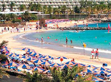
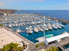
Residents and visitors across the main resort areas of Playa Blanca, Puerto del Carmen, Costa Teguise and Arrecife are being advised to take sensible precautions during the warmest hours of the day. While coastal locations will benefit from the moderating effect of Atlantic sea breezes, temperatures across all four areas are still expected to sit comfortably above 30°C during the peak of the heatwave on Sunday, Monday and Tuesday.
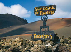
Inland communities, the volcanic interior and the higher ground around Tías, Tinajo and the wine-growing area of La Geria are likely to record the most intense readings, with reduced air movement away from the coast allowing daytime heat to build through the afternoon. Visitors planning excursions to Timanfaya National Park, Mirador del Río or the northern routes around Haría should plan around the temperature profile of the day rather than the calendar.
Wildfire Pre-Alert Activated on Other Islands
The Government of the Canary Islands has activated wildfire pre-alert measures across the western islands and Gran Canaria in response to the elevated risk. The pre-alert applies to Tenerife, La Palma, La Gomera, El Hierro and Gran Canaria, which between them hold the forested terrain and higher altitudes where the wildfire framework concentrates. The measures cover areas above 400 to 600 metres in altitude depending on the slope and orientation of the land, and place emergency services and fire response teams on heightened readiness for the duration of the warning period.
Lanzarote and Fuerteventura are not included in the current pre-alert. The eastern Canary Islands lack the forest cover and elevation profile that trigger the INFOCA wildfire framework, and the wildfire risk on the two eastern islands during heatwave conditions is correspondingly lower than on the western islands. Visitors and residents on Lanzarote should still avoid discarding cigarettes, glass or any other items capable of starting a fire in dry vegetation, but the wildfire warning itself does not apply to the island.
Extreme UV Adds to the Risk
The most significant safety consideration accompanying the heat on Lanzarote is the strength of the ultraviolet radiation. AEMET has confirmed UV index readings of 10 across Sunday, Monday and Tuesday, following a peak of 11 on Saturday. Any reading of 8 or higher is classified as very high by the World Health Organization, with 11 and above classed as extreme. At these levels, unprotected skin can burn within minutes during peak hours, and eye damage can occur without proper UV-blocking sunglasses.
The combination of extreme UV and high temperatures requires more care than would normally be expected during a typical May week on the island. Sunscreen of factor 30 or higher should be applied generously and reapplied every two hours, with more frequent application after swimming. The hottest and most UV-intense window of the day runs from late morning through to mid-afternoon, and the standard guidance from AEMET and Canary Islands health authorities is to seek shade, indoor venues or shaded poolside areas between 11am and 4pm.
Hydration and Care for Vulnerable Visitors
Authorities are advising visitors and residents to stay properly hydrated, avoid prolonged sun exposure and check regularly on anyone particularly vulnerable to heat-related illness. Adults are typically recommended to drink between two and three litres of water across the course of the day during extreme heat, with significantly higher intake required for anyone exercising or working outdoors. Thirst is a late indicator, and proactive drinking is more effective than reactive sipping once dehydration has begun.
Older visitors, young children and anyone with cardiovascular, respiratory or other chronic conditions are at higher risk during heatwave conditions and benefit from particular attention during the warmest part of the day. The early warning signs of heat exhaustion include headache, dizziness, nausea, reduced sweating and unusual fatigue, and any progression to confusion, very high body temperature or loss of consciousness requires emergency medical attention without delay.
How Long the Heatwave Will Last
The current AEMET forecast indicates that the heatwave will continue into at least Tuesday 26 May, with conditions then beginning to ease gradually through the middle of the week. Temperatures are expected to step down to 29°C on Wednesday and 28°C on Thursday, returning closer to the seasonal norm by the end of the period. AEMET will continue to monitor conditions across the Canary Islands throughout the warning window, with any updates or extensions to the alert being published through its official channels.
Practical Advice for the Days Ahead
Tourists planning beach visits, boat excursions or water sports across the weekend and early part of next week will find conditions broadly excellent for those activities, provided that sun protection is taken seriously and time in direct UV is managed carefully. Hiking, cycling and longer walking activities, particularly through the volcanic landscapes of the interior, are best confined to the early morning or late afternoon rather than the middle of the day.
For visitors currently on the island, the message from authorities and weather services is consistent. The temperatures and UV levels forecast across the coming days are at the high end of what Lanzarote normally records, and the precautions that make the difference are the straightforward ones. Water, shade, sunscreen, sensible timing and an eye out for friends and family members who may be struggling. Handled properly, the heatwave will produce some of the most enjoyable beach and pool days of the year so far.